Come
sovrapporre l'immagine di una carta alle immagiuni satellitari di
Google Earth
How
to overlay a topographic map on satellite
images
of Google Earth.
 Nei
miei viaggi in fuori strada mi capita spesso di voler cercare rotte
fuori dagli itinerari più battuti. Per fare ciò utilizzo le
immagini satellitari di Google Earth e l'opzione “NUOVO PERCORSO”
di questo utilissimo programma. Succede però a volte che la traccia
che stiamo ricalcando scompaia sotto un fitto bosco, per cui sia
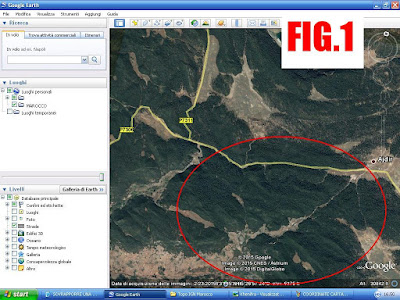
impossibile seguirla (FIG.1).
Oppure può accadere che ci sia stato
indicato un percorso su una mappa topografica, e lo si voglia
trasferire sul GPS in formato “gpx”, ricalcandolo appunto su
Google Earth.
Per
ovviare a questi inconvenienti possiamo utilizzare il pulsante
“SOVRAPPONI IMMAGINE” del programma, per andare a far combaciare
la carta a nostra disposizione con le immagini satellitari.
In my off-road travels I often want to look for routes off the beaten tracks. To do this I use the satellite images of Google Earth, and the function "NEW PATH" of this useful program. But it happens sometimes that followed trail disappears in a dense forest, so it is impossible to trace it (Fig.1). Or it may be that I have a route on a topographical map, and I want to transfer it on my GPS in "GPX" standard file format, tracing precisely on Google Earth.
To overcome these drawbacks, we can use the "IMAGE OVERLAY" function, to go to match the map with satellite imagery.
Ma vediamo ora come dobbiamo procedere:
But let's see how we proceed:
Scannerizzate la mappa che avete a disposizione. Più precisa e dettagliata sarà la scannerizzazione, migliore sarà il risultato.
Scan map you have available. More accurate and detailed the scan, then better the result.
Individuate le coordinate degli estremi della carta scannerizzata (FIG.2) per questo esempio userò la carta IGN 1:200.000 dell'area di Khenifra in Marocco.
Find the coordinates of the corners of the paper scanned (FIG.2) for this example I will use the card IGN 1:200,000 of the area of Khenifra - Morocco.

Su Google Earth, usate la funzione “SEGNAPOSTO”, inserendo 4 segnaposto con le coordinate dei 4 estremi della carta topografica, ricopiandole negli appositi campi.(FIG.3)
On Google Earth use the "MARKER" button, entering the fourth placeholder with the
coordinates of the four extremes of the map, literally traced in the fields. (FIG.3)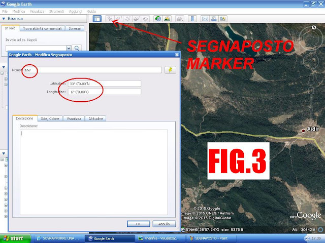

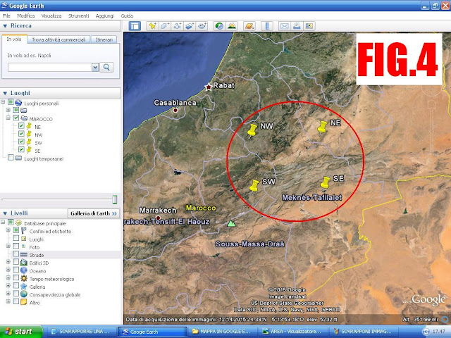
Avrete così i segnaposti nei quattro estremi della carta. (FIG.4)
So you will have placeholders in the four corners of the paper. (FIG.4)
con la funzione “SOVRAPPONI IMMAGINE” selezionate il file corrispondente alla carta scannerizzata, avendo cura di nominare l'immagine come la carta stessa. (FIG.5)
Using the "IMAGE OVERLAY" select the file that matches the paper scanned, making sure to name the image as the map itself. (FIG.5)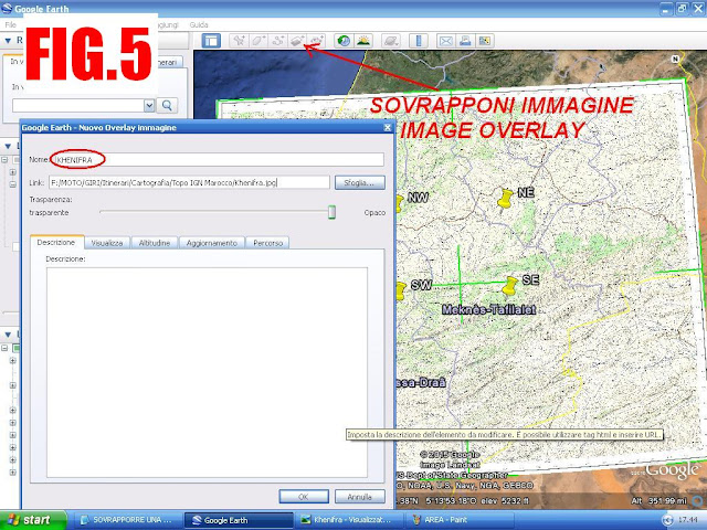

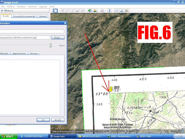
Spostate gli angoli dell'immagine in modo che coincidano con i segnaposto (FIG.6)
Move the corners of the image to coincide with markers (FIG.6)
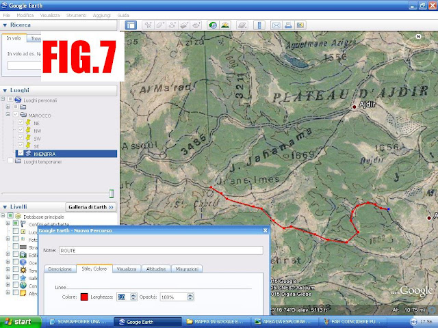
Adesso tornate nell'area che vi interessa e ricalcate direttamente la rotta dall'immagine della carta topografica. Salvate il file gpx e scaricalo sul GPS. (FIG.7)
Now go back the area that you're interested in, and trace the route directly from the one draw in the map.. Save the GPX file and download it to your GPS. (FIG.7)
E ora non resta che preparare qualche traccia per una nuova Avventura!
And now, let's prepare some track for a new Adventure!
Nessun commento:
Posta un commento